Route & Stops Map
Welcome to our Routes and Stops page. Here, you’ll find all the information you need to find our coach stops with ease at London Liverpool Street, London Stratford, and Stansted Airport. As well as easy to understand maps, we have also provided information on the connections available at each so you can continue your journey with no fuss or hassle.
Stops Map
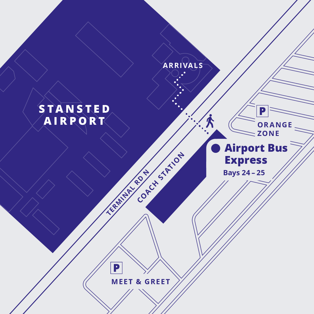
London Stansted Airport:Bays 24-25
Airport Bus Express coaches are at Bays 24 and 25 in the coach station on
Terminal Road North , next to the Arrivals area of the main terminal. The bays
are clearly marked, so you shouldn't have any issues finding your coach. Our
multilingual staff is on hand to help you stow your luggage and get settled before
departure. Our Express coach service leaves every 30 minutes, and your journey
time into London Stratford down the M11 motorway is approximately 45 minutes.
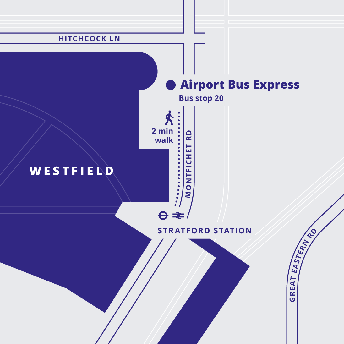
London Stratford:Bus stop 20
Our primary hub is located at London Stratford in the East End, making it quick
and easy to get to central London and avoiding the heavy congestion in the city
centre. Our coaches depart and arrive at Bus Stop 20 on Montfichet Road ,
next to the entrance of Westfield Shopping Centre.
The bus stop is a two-minute walk from Stratford Underground and Overground
station, where you can connect with the Jubilee Line, Central Line, and Elizabeth
Line underground routes, as well as the Overground connection to north London
and the Docklands Light Railway service to Canary Wharf and the financial
district.
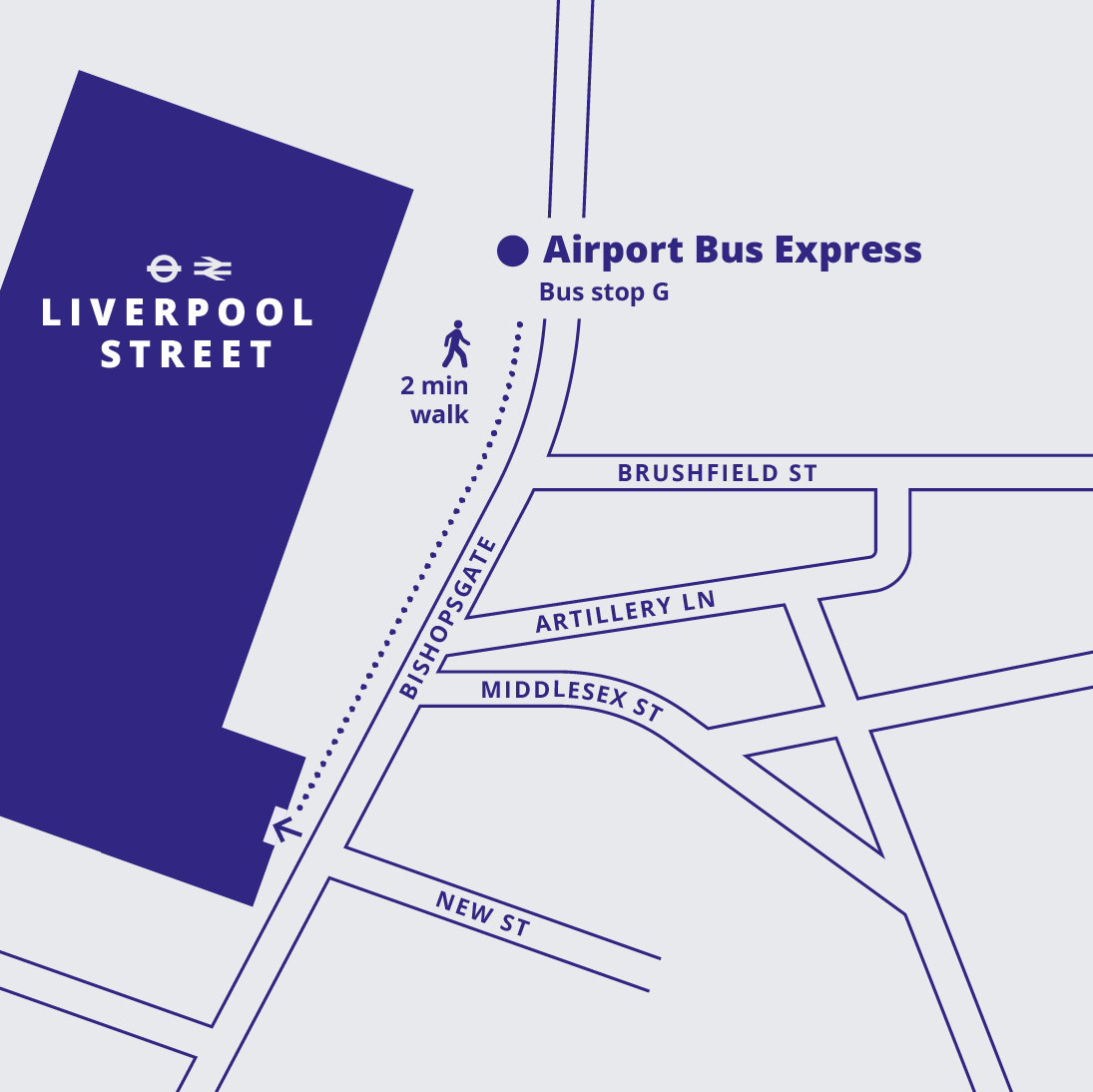
London Liverpool Street:Bus stop G
One of the capital's most important transport hubs, London Liverpool Street
connects the east of the country with the city through Network Rail, London
Overground and Underground services, and bus, taxi, and Uber services. Our bus
stop at Liverpool Street is located at Bus Stop G, Bishopsgate 175. You’ll find
your stop almost opposite Artillery Lane, next to the station's entrance.
From Liverpool Street, you can connect with the Central, Circle Line,
Hammersmith & City Line, the Elizabeth Line and the Metropolitan Line. There is
also a large taxi rank outside the station, as well as bus stops for various London
bus routes both north and south of the river.
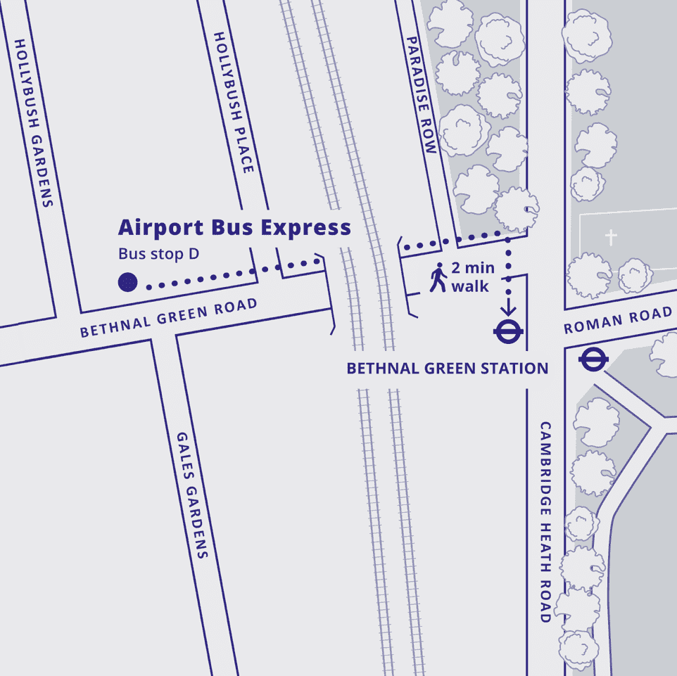
London Bethnal Green:Bus stop D
Bethnal Green, a vibrant district in East London, boasts excellent transport connections. Situated on the Central Line, it offers direct access to major London attractions and business hubs. Additionally, the area is served by numerous bus routes, providing convenient connections to other parts of the city. For those who prefer cycling, Bethnal Green benefits from well-maintained cycle lanes and docking stations for the popular Santander Cycles scheme. With its diverse transport options, Bethnal Green is well-connected to the rest of London, making it a convenient and accessible place to live, work, or visit.
Route Map
